Plan Framework
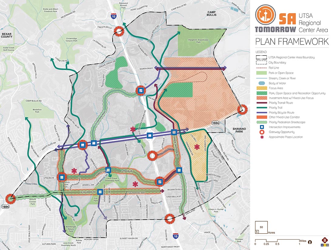
The Plan Framework map identifies and shows the interrelatedness of key physical concepts and strategies in the UTSA Area Regional Center Plan. Priority focus areas and mixed-use corridors for (re)development are places where people can live, work, study, and play. Public gathering spaces provide opportunities for community events and activities. Streetscape and intersection improvements, along with improved trails and bicycle routes, allow safe travel across the plan area and increase access to the many parks, creeks, and trailheads. These improvements should be protected by utilizing green stormwater infrastructure and low impact development best management practices to capture and treat stormwater runoff. Gateway opportunities along I-10 and Loop 1604 highlight the area’s amenities such as trails and greenways, entertainment and retail destinations, and the UTSA Campus.